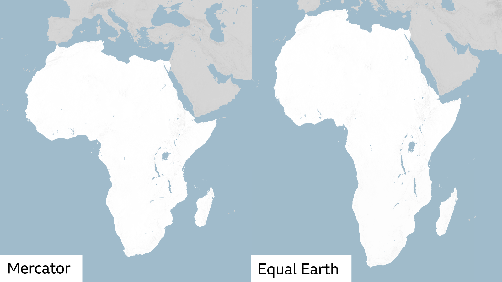
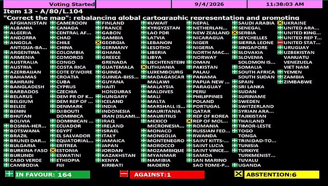
The United States found itself isolated at the United Nations General Assembly after voting against a resolution promoting the use of the Equal Earth map projection, an initiative backed largely by African countries seeking a more accurate representation of the continent’s geographical size.
The resolution received 164 votes in favour, while six countries abstained. The United States cast the only opposing vote.
At the centre of the initiative is a longstanding concern over the Mercator projection, developed by Flemish cartographer Gerardus Mercator in 1569. Although the projection proved highly valuable for maritime navigation, its method of transferring the spherical Earth onto a flat surface significantly enlarges territories closer to the poles while diminishing their relative scale compared with land masses nearer the equator.
Africa is among the clearest examples of that distortion. Greenland can appear almost comparable to Africa on a Mercator map, despite Africa covering more than 30 million square kilometres and being approximately 14 times larger.
African governments supporting the resolution argue that the continued widespread use of such maps in education, media and public institutions has consequences beyond geographical accuracy.
Togo’s Foreign Minister Robert Dussey, whose country played a leading role in advancing the initiative, said maps contribute to the way societies understand the world around them.
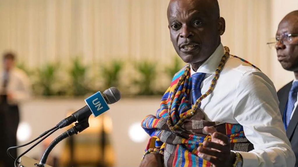
“A map is never neutral,” Dussey said. “It shapes perceptions and influences how we see the world.”
The United States did not dispute the considerable difference between Africa’s actual size and its appearance under the Mercator projection. Instead, its representative questioned why the General Assembly should devote its attention to the issue.
“Instead of focusing on genuine problems of international peace, prosperity or good relations, this body is debating map projects from the 16th century,” the US representative said.
Washington also objected to the wider political framing surrounding the initiative, particularly references to colonial legacies, reparations and what supporters have described as correcting historical perceptions of Africa.
That explanation places the American vote within a broader disagreement over the purpose of the resolution. While its African sponsors view the map issue as one of representation and historical accuracy, the United States considers the campaign part of a wider political agenda that it does not believe should occupy the General Assembly.
The position has nevertheless drawn particular attention because of the Trump administration’s own recent interest in how geographical features are represented and named on maps.
President Donald Trump ordered US federal agencies in 2025 to adopt “Gulf of America” in place of the Gulf of Mexico, a name that had been internationally recognised for centuries. His administration subsequently sought corresponding changes on widely used digital mapping services.
The administration has taken a similar approach towards Lake Ontario, which Trump ordered US authorities to refer to as “Lake America” in August 2026.
Those decisions are fundamentally different from changing a cartographic projection. One concerns geographical names, while the African initiative concerns the proportional representation of land masses. However, they have inevitably become part of the discussion surrounding the US vote because both involve the significance governments attach to what citizens see on maps.
The contrast has provided African supporters of the resolution with an obvious question over Washington’s position: if the names displayed on maps are sufficiently important to warrant presidential intervention, the geographical representation of an entire continent cannot easily be dismissed as insignificant.
The African initiative is also not seeking the abolition of the Mercator projection. Its usefulness for navigation is well established, and the circumstances surrounding its creation in the 16th century were very different from the political meaning sometimes attached to it today.
The concern is instead about its continued use as a general representation of the world, particularly in classrooms and institutions where viewers may reasonably assume that the relative sizes displayed on the map reflect geographical reality.
The Equal Earth projection, introduced in 2018, was developed to preserve the relative areas of countries and continents while maintaining recognisable geographical shapes. Under that projection, Africa occupies substantially more space than many people accustomed to Mercator maps may expect.
The debate therefore extends beyond whether one projection should replace another. For African governments, it concerns how a continent of more than a billion people has been visually represented to generations around the world and whether a historical distortion should continue when alternatives are readily available.
For the United States, the issue is different. Its vote indicates that Washington considers the political and historical arguments surrounding the initiative unnecessary within a UN system already dealing with wars, economic instability and other major international challenges.
That position explains why the United States voted no.
It does not, however, alter the geographical fact underlying the African campaign. The proposed maps do not enlarge Africa, nor does the UN resolution give the continent territory it did not previously possess. They seek to represent more faithfully the land area that has always been there.
 United States